


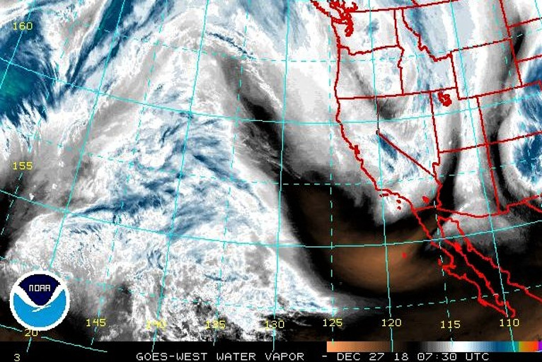
Snow showers will persist into Thursday morning across the mountains, lowering to the foothills as Upper-level energy over the Pacific Northwest moves southward forming an upper-level low by Friday morning.
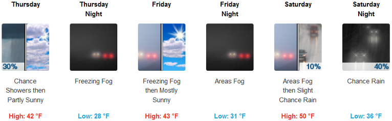
Brookings:

The storm will produce coastal rain and higher elevation snow over parts of the Pacific Northwest. The rain will end over the Northwest coast by Thursday evening.Furthermore on Friday, onshore flow will aid in producing rain and higher elevation snow over parts of the Pacific Northwest.
This is bringing snow to some area roads, especially over the passes in the Southern Oregon Cascades. Snow levels around 3500 feet lowered to around 2500 feet Wednesday night. Expect 4 to 6 inches of snow over the Cascades near Crater Lake and Diamond Lake with 2 to 4 inches of snow as far south as Lake of the Woods and over upper portions of Mt. Ashland ski road. Snow accumulations are most likely Wednesday evening and night. Snow showers will diminish Thursday morning.
Make sure to carry chains, food, water, blankets, flashlights, medications, and a fully charged phone when traveling.
Please Like, Share and Follow the …
![]()