


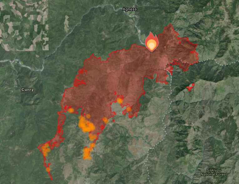
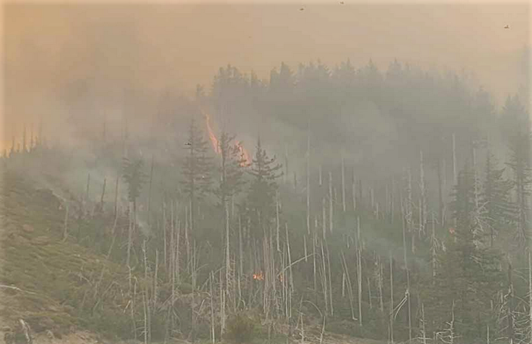
Flat Fire updates to close the week Friday morning show growth has continued to remain relatively slow, growing 2,263 acres, 1,131 acres per day since Wednesday mornings update, and now covering more than 24,329 total acres.
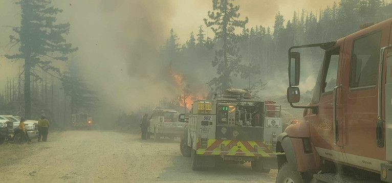
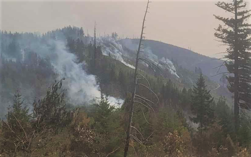
Fire officials concerned about fire growth to the south continued control burns ahead of the fire, although some areas paused burning operations due to wind direction as firefighters in other areas took advantage of favorable weather conditions by reinforcing and building additional fire lines to slow progress to the east.
Helicopters were active along the southeast perimeter and control burns were used to secure additional fire lines down to Snow Camp after four fire crew personnel rappelled ahead to control and mop up the spot fire along the fires edge and hot spots further inside fire lines.
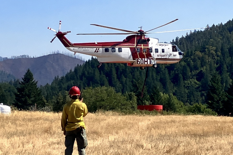
Currently the U.S. Forest Service has deployed 1,644 total personnel, 50 Engines, 38 crews, 8 bulldozers, 34 water tenders, 11 helicopters, and 8 masticators, used to grind or chew woody debris into one to two inch pieces leaving behind chipped woody debris.
Air resources continue to be utilized as conditions and visibility allow and additional resources continue to arrive and to strengthen and create new firelines while looking for opportunities to use existing roads and bodies of water as natural fire breaks.
A Level 1 “Get Ready” evacuation notice remains in effect for areas on the north side of the Rogue River in Old Agness up to Illahe Lodge and along the Rogue River Corridor from Quosatana Creek Campground to the Agness area. This includes the areas of Spud Road, Old House Creek Road and Oak Flat.
Weather conditions are expected to warm and dry over the next few days with winds from the northeast to northwest, gusting to around 20 mph.
Fire Restrictions remain in place, including campfires, which are only permitted in designated campgrounds that have metal fire rings. Ensure your campfire is thoroughly extinguished before leaving. fs.usda.gov/rogue-siskiyou
The area immediately east of Agness remains in a Level 2 due to an abundance of caution. Some areas outside the burn area to the southwest will remain in Level 2 while fire crews continue to further secure control lines. The Curry County Sheriff’s Office will continue to coordinate with the Fire Incident Management Team and will notify all residents affected by the fire of any reasons to change evacuation levels. Curry County is using Everbridge to send evacuation notices. You can sign up for notifications here: https://www.co.curry.or.us/departments/emergency_management/index.php
The Rogue River Siskiyou National Forest has issued a closure order for the fire area including trails, roads and a portion of the Illinois River. Oak Flat Campground, Game Lake Campground, Wild Horse Campground and Snow Camp Lookout Recreation Rentals are all part of the area closure.