

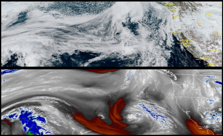
Another round of precipitation is forecast to begin producing rain along the northern California and southern Oregon coast very early Friday morning and continuing through out the weekend. Snow levels will start very high over passes, but could fall to valley floors by late Sunday.
Inland areas will see cloudy skies to start Friday, with rain forecast to begin late Friday evening and snow levels as high as 3900ft, dropping as the weekend progresses. Winds are expected to start from 5 to 10mph increasing to 20mph with early morning lows in the upper 30’s dropping to upper 20’s later in the weekend, and afternoon highs in the upper 40’s.
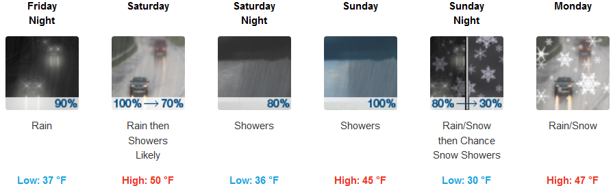
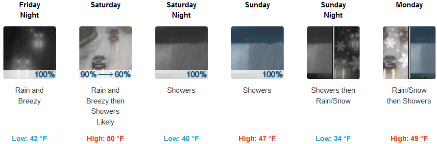
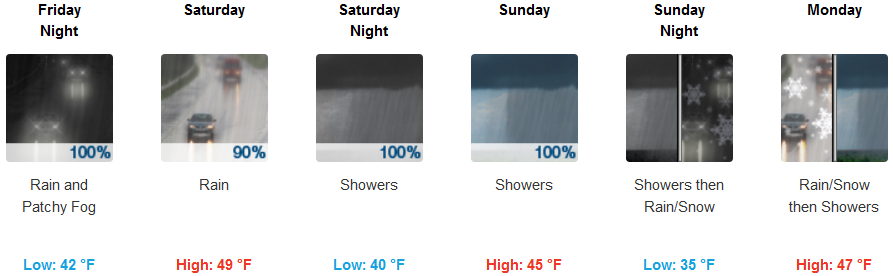
Coastal areas will see localized showers beginning very early Friday morning as colder unstable air moves onshore and continuing throughout the weekend. Winds are forecast to be light Friday, increasing to possible gusts of over 30mph. Again, snow levels will begin high across the passes, dropping down to 2000ft by late Sunday. Afternoon highs are not forecast to break 50, hovering in the mid to upper 40’s with early morning lows falling to the mid to upper 30’s late in the weekend.
Brookings:
Crescent City:
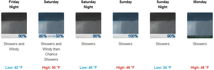
Gold Beach:
Cave Junction:
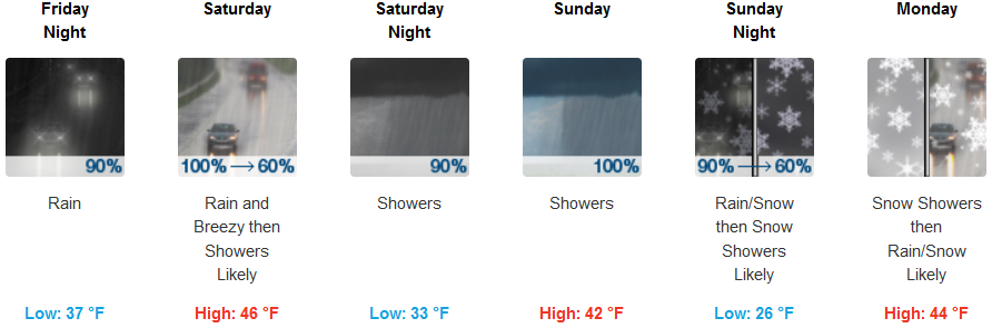
Grants Pass: