

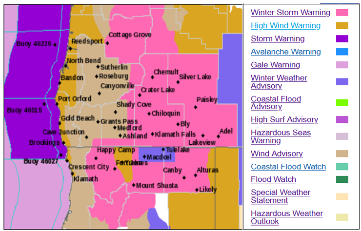
As a new weather fronts push down into the northwest after the holiday weekend, the 2022 workweek will start with weather advisories across the region, including, High Wind Warnings beginning late Sunday evening bringing possibly damaging south winds into early Tuesday in some areas. Heavy rain is also associated with this system prompting a Winter Storm Warning inland into Tuesday.
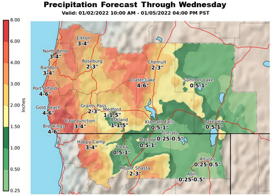
A series of fronts is likely to bring periods of moderate to heavy precipitation totaling 2 to 6 inches of water over much of southwestern Oregon and far northwestern California into Wednesday, January 5th. Snow levels will generally rise during this time period leading to melting of the lower elevation snowpack across the area. This will lead to rapid rises on area streams, creeks, and rivers, as well as possible flooding during this time period.
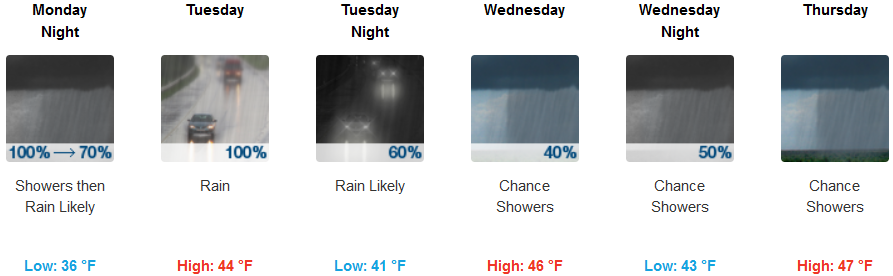
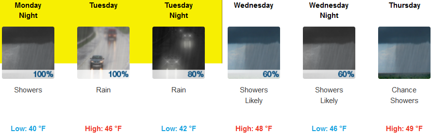
Inland precipitation is forecast through the week, with heavy rain creating a potential for small creeks and streams to flood west of the Cascades. Current forecasts show rivers below flooding, but significant rises are expected as another rain event, with higher snow levels is expected Tuesday afternoon through Tuesday night with the National Weather Service issuing localized Flood Warnings across the region. Snow elevations are forecast to start at a low of 2900 ft, however, travel across all passes is expected to be impacted. Temperatures across inland areas are forecast to be in the upper 30’s for lows, and the mid 40’s for highs.
Coastal regions will see high winds into late Monday afternoon with showers and possibly a localized thunderstorm in the area. Very strong winds and heavy rain are forecast early in the week with the highest winds and moderate to heavy rain creating a flood warning from the National Weather Service for the south central Oregon coast and Curry County Coast, including the cities of Brookings, Gold Beach, Port Orford and into northern California, as the combination of astronomical high tides and periods of heavy rain create possible flooding situations on small creeks and streams. Temperatures along the coast are forecast to be warmer than inland temperatures with highs in the low 50’s and early morning low temperatures in the mid 40’s.
Brookings:
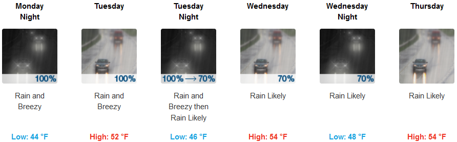
Crescent City:
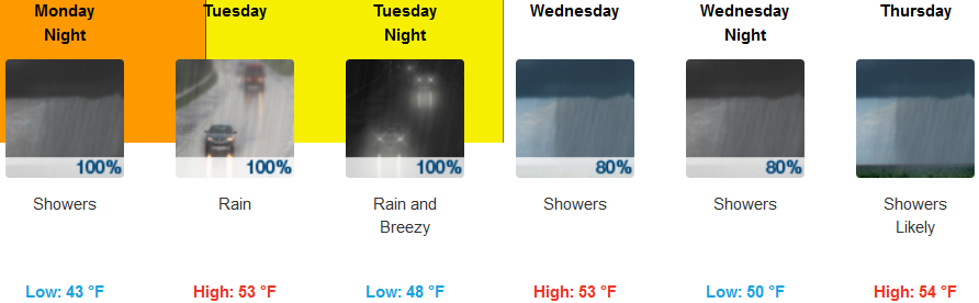
Gold Beach:
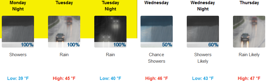
Cave Junction:
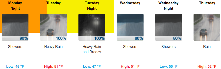
Grants Pass:
Medford: