

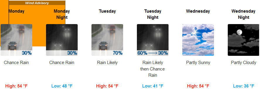
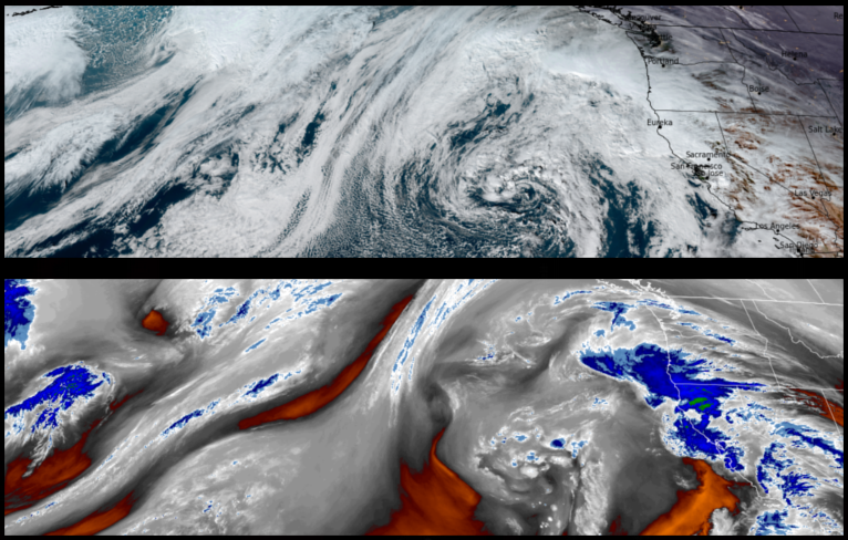
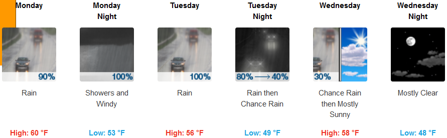
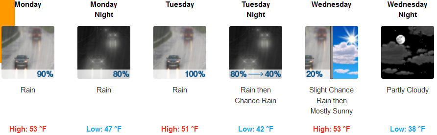
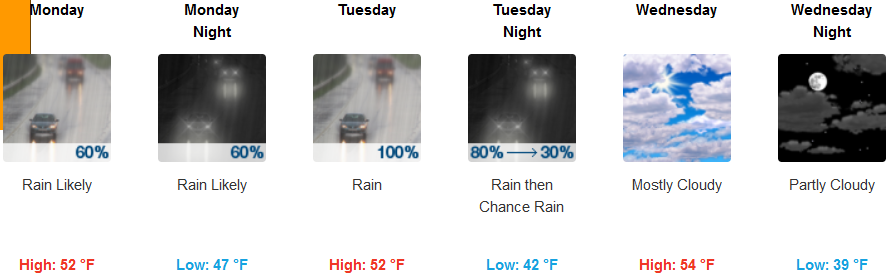
A large high pressure system has established off the coast and is circulating unstable weather into the area from the south. High winds are are expected Monday morning through Tuesday morning across portions of southern Oregon and northern California with rain forecast into mid-week.
Inland areas are expected to wake up to precipitation to start the work week Monday morning, continuing into Wednesday. Temperatures will be in the mid to upper 40’s for lows, cooling as the week progresses, with highs in the low 50’s.
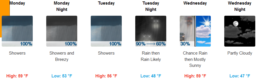
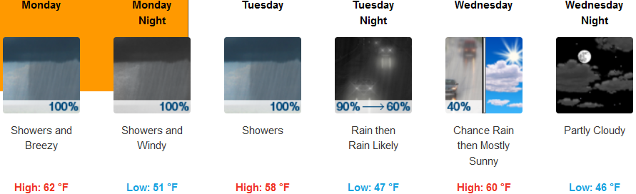
Coastal areas could wake up to showers and possibly thunder storms Monday morning as cooler air moves back into the area. Rain is forecast through mid-week with the approach of another system Tuesday. Morning lows are expected to be in the upper 40’s cooling to the low to mid 40’s mid week with highs in the mid to upper 50’s.
Brookings:
Crescent City:
Gold Beach:
Cave Junction:
Grants Pass:
Medford: