

A weak frontal system was expected to brush northwestern portions of the area Sunday into Monday with rain and mountain snow. .
A strong storm system is expected to bring rain and mountain snow starting Tuesday afternoon. The heaviest precipitation will be Tuesday afternoon and evening. Showers will continue through Wednesday, although they will be much lighter and will taper off in the evening.
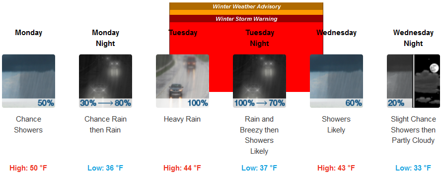
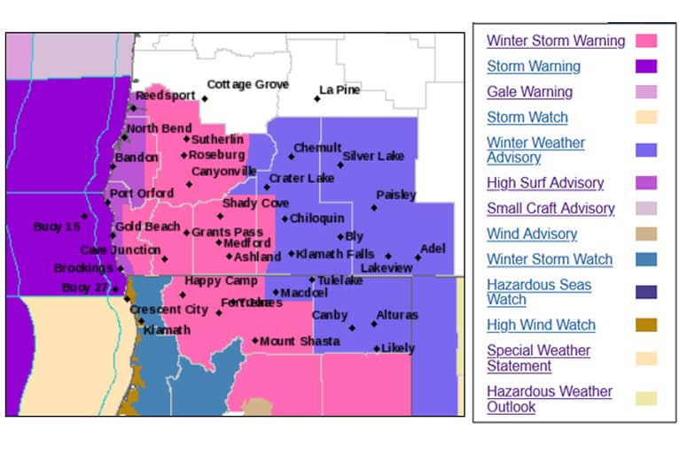
Brookings:
Crescent City:
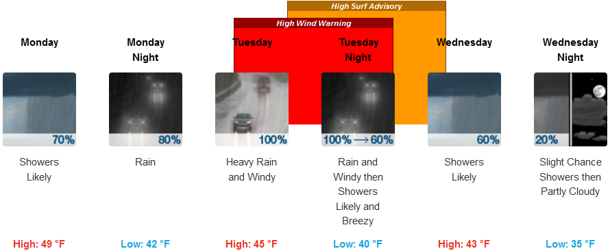
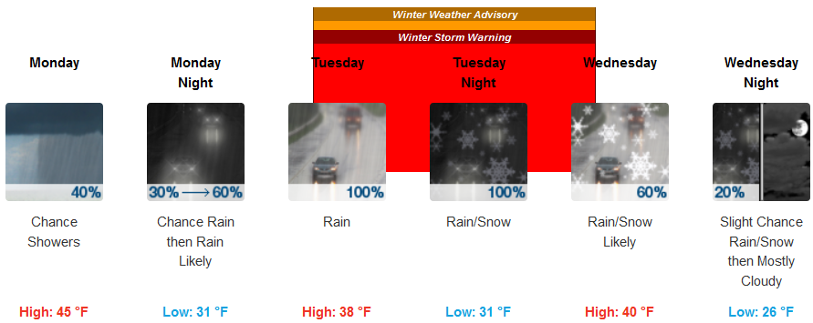
Gold Beach:
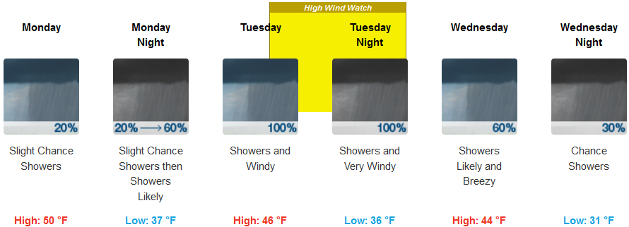
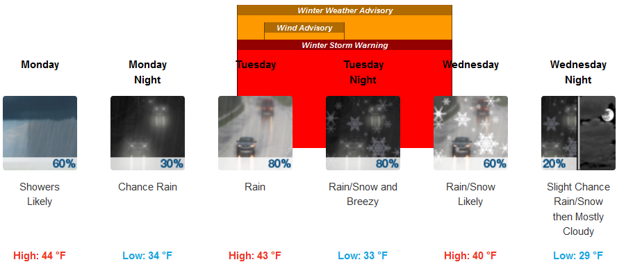
Cave Junction:
Medford:
Snow levels will drop to the valley floors Wednesday morning, but by that time the bulk of the precipitation will be done and expected amounts are very light. This means I-5 from Mount Shasta to Ashland, especially on Siskiyou Summit, could be affected by accumulating snow, as well as the higher passes AND areas east of the Cascades.
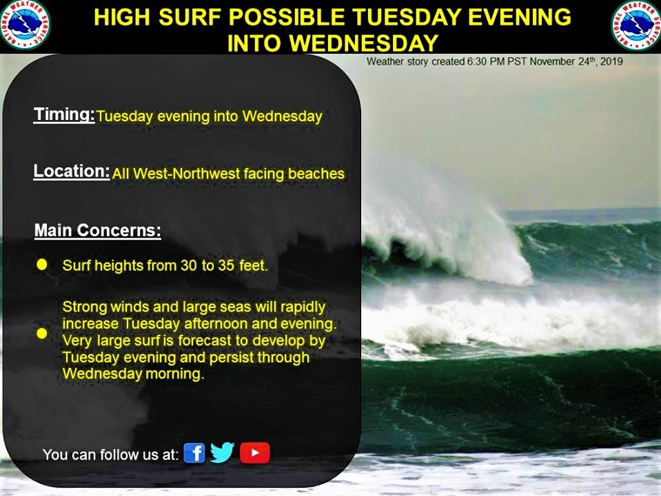
Latest data suggests rapidly deepening low pressure along the coast near OR/CA border, which is commonly referred to as a “bomb cyclone”. This means the potential for high winds along the Southern Oregon coast and widespread windy conditions elsewhere.
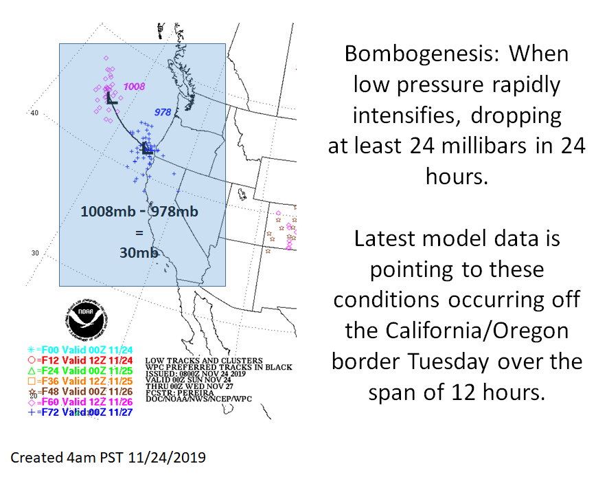
This strong low pressure system will generate storm force winds and large seas across the Pacific waters. Large dangerous surf conditions from 30 to 35 feet will subsequently develop for west-northwest facing beaches Tuesday evening into Wednesday.