

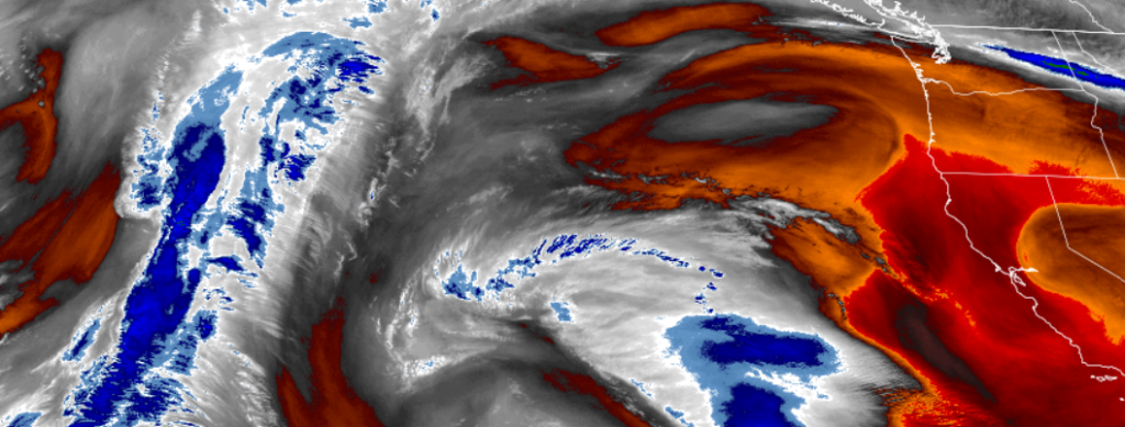
The high pressure system circulating off the California coast that has been pushing north pacific storm systems to our north, has moved to the north and west and is expected to swing moisture into the southern Oregon and northern California regions possibly as early as late Sunday.
As the work week comes to a close, a mild air mass combined with offshore flow will continue to produce unseasonably warm temperatures in the upper 70’s and 80s through Saturday with the potential to break several daily record highs from San Diego, California, to Medford, Oregon.
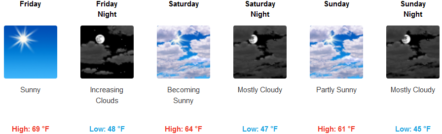
Inland high temperatures will be in the low to mid 70’s with a large temperature inversion to early morning lows that could drop to freezing in some isolated locations with a very slight chance of precipitation very late Sunday evening.
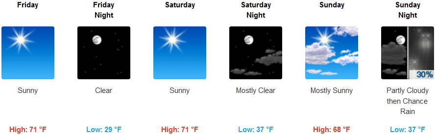
Coastal areas will continue to see mostly clear skies and mild temperatures as the work week closes and into Saturday. Temperatures are expected to in the upper to mid 70’s, with low temperatures in the low 50’s, gradually cooling to the low 40’s by Sunday.
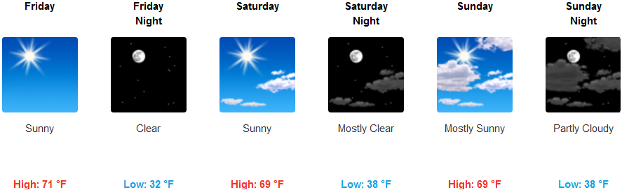
Brookings:
Crescent City:
Gold Beach:
Cave Junction:
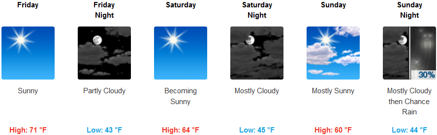
Grants Pass:

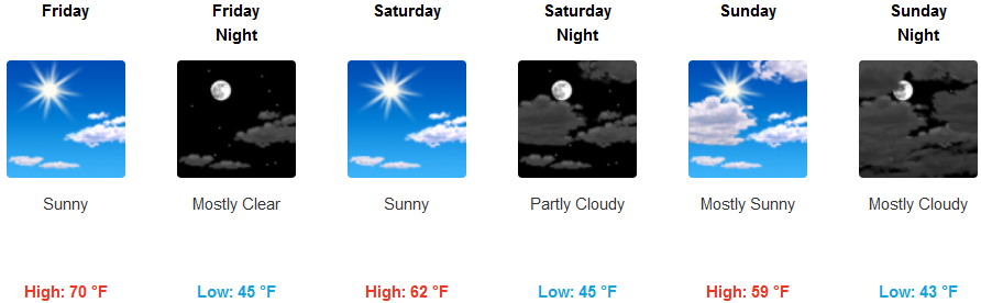
Medford: