

A trough of high pressure spinning off the Oregon coast will be responsible for the extended period of mostly clear skies forecast for the upcoming workweek.

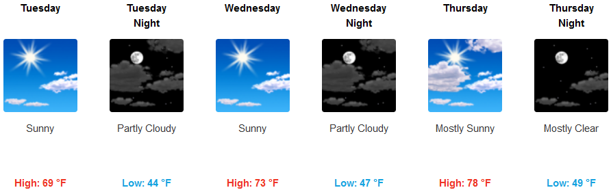
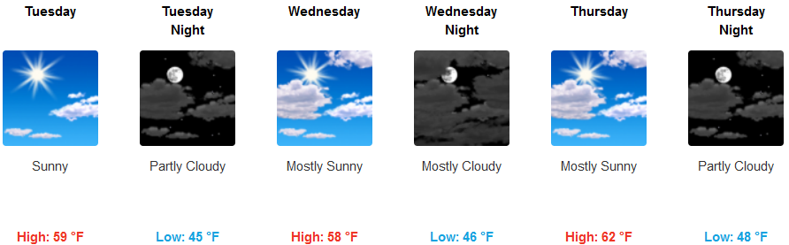
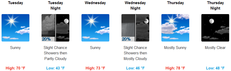
Inland areas are forecast to see partly cloudy to mostly sunny skies for the workweek with temperatures rising steadily and rapidly as the week progresses, however, the upper level low pressure system that brought the last bought of precipitation continues to circulate over eastern Oregon and could bring period of localized showers as it spins unsettled weather from the edge of the system through the valley. High temperatures are expected to rise to the low 80’s by the weeks end.
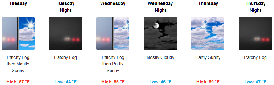
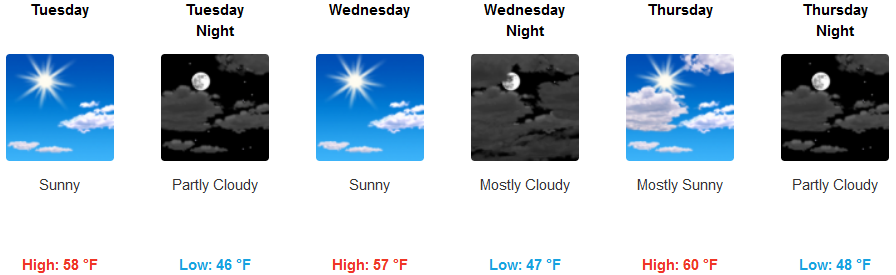
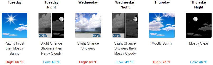
On the coast, skies are expected to partly cloudy to partly sunny throughout the week, with patchy localized areas of fog in the usual places. Afternoon highs along the coast are expected to steadily rise through the week, going from the mid 50’s Tuesday, to the upper 60’s as the work week progresses.
Brookings:
Crescent City:
Gold Beach:
Cave Junction:
Grants Pass:
Medford: