

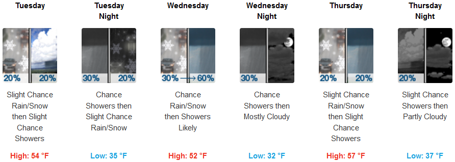
Weak weather systems are forecast to continue creating coastal rain and high elevation snow into Wednesday and possibly early Thursday.
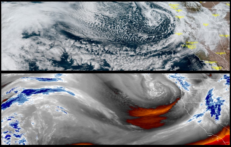
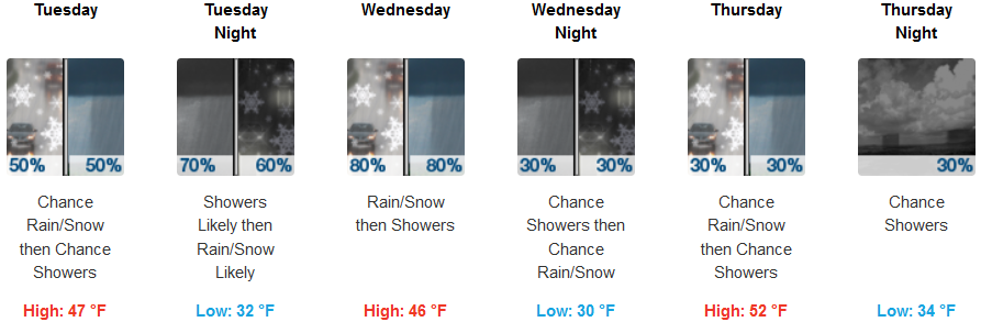
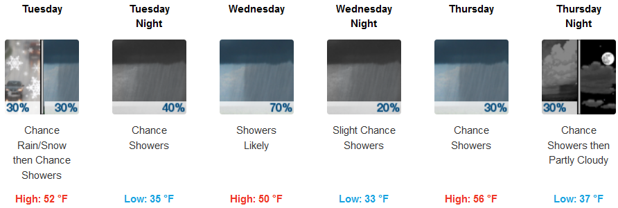
Inland areas can expect snow accumulations if any at the highest elevations, however rain and snow are expected, heavy at times with possible thunder storms as a series of frontal systems move across southern Oregon and northern California. Temperatures will stay in the low 30’s for early morning lows, possibly getting to the mid 50’s for afternoon highs.
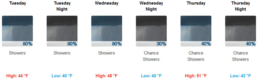
Along the coast, rain and possible thundershowers are expected to continue through the work week with wind gusts reaching the low 20’s in some areas. Temperatures will remain moderate with afternoon highs getting the low 50’s and lows hovering in the low to mid 40’s.
Brookings:
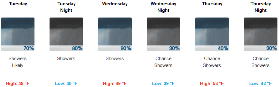
Crescent City:
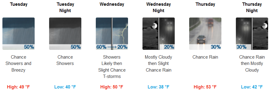
Gold Beach:
Cave Junction:
Grants Pass:
Medford: