

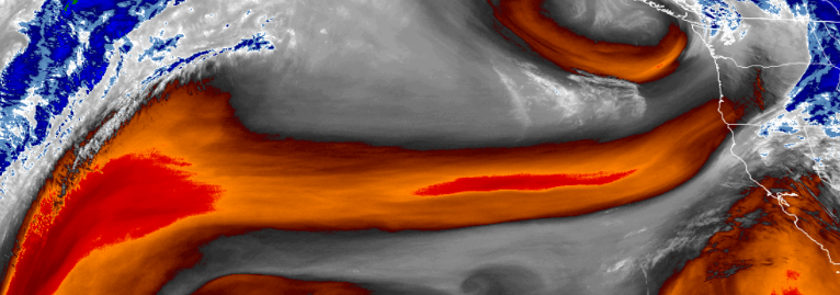
The ridge of high pressure that has been stationed off the California coast and responsible for the clear warm weather we have been experiencing this past few days, has moved to the north, allowing the weather pattern to push low pressure systems from the pacific northwest to circulate further south.
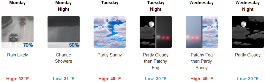
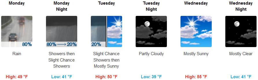
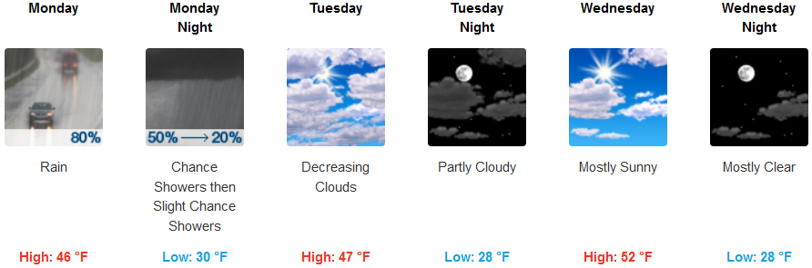
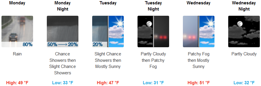
An early Monday morning weather system has begun to affect southern Oregon and northwest California to start the work week, with temperatures expected to stay low during the week.
A weak storm system that moved into the area Sunday evening into Monday morning is expected to bring less than a quarter inch of precipitation to the area, with the possibility of light amounts of snow at higher elevations as the cold front quickly moves through the forecast area Monday afternoon, into late Monday evening.
Inland areas are forecast to see precipitation begin after mid morning, to noon, continuing into early Tuesday morning before becoming partly cloudy later Tuesday to continue the work week. Early morning lows could get to the mid 30’s in some areas with isolated morning fog in some areas, and afternoon highs reaching the mid 50’s.
Showers are likely along coastal areas Monday, and into late Monday evening, with a southwest wind early, changing to northeast wind late Monday afternoon, gusting as high as 21 mph before changing to partly cloudy skies as the work week progresses. Temperatures are forecast to remain moderately cool with lows in the low 40’s, and highs hitting the mid 50’s in some areas.
Brookings:
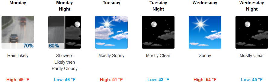
Crescent City:
Gold Beach:
Cave Junction:
Grants Pass:
Medford: