

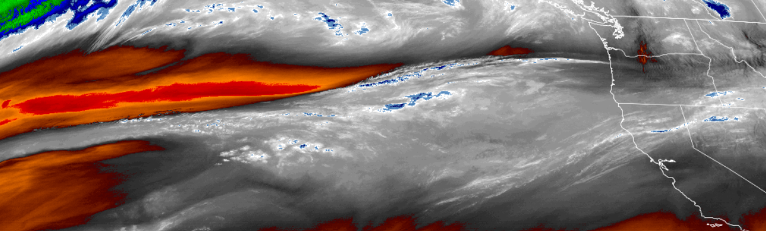
A wet fall weather pattern has moved into the area bringing cool temperatures and more precipitation through out the work week. A pause is expected late mid-week before more showers are expected as a weather system dips into the southern Oregon and northern California regions.
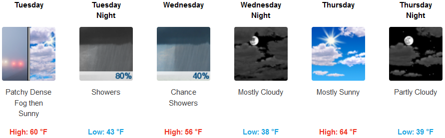
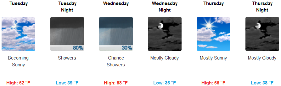
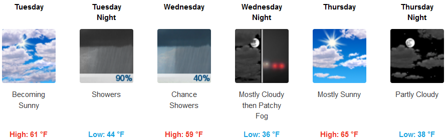
Areas inland are forecast to see mostly cloudy skies to start Tuesday changing to a substantial chance of rain by late Tuesday evening. Precipitation is expected to stop Wednesday morning, changing to mostly to partly cloudy skies later in the week. High temperatures are expected to remain in the upper to lower 60’s, with early morning lows possibly reaching freezing in some low lying valleys.
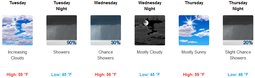
Along the coast significant chances for rain will start Tuesday as showers roll on shore late Tuesday evening, dissipating late Wednesday morning. Mid to upper 50’s are expected through out the week. Chances for localized fog in some low lying areas are expected Thursday morning, with temperatures in the mid 50’s for highs and the middle to lower 40’s for the morning lows.
Brookings:
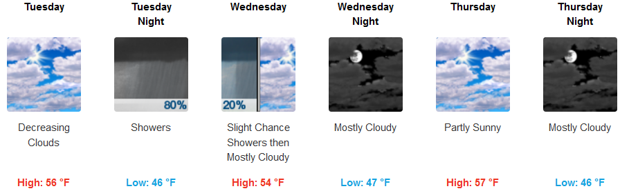
Crescent City:
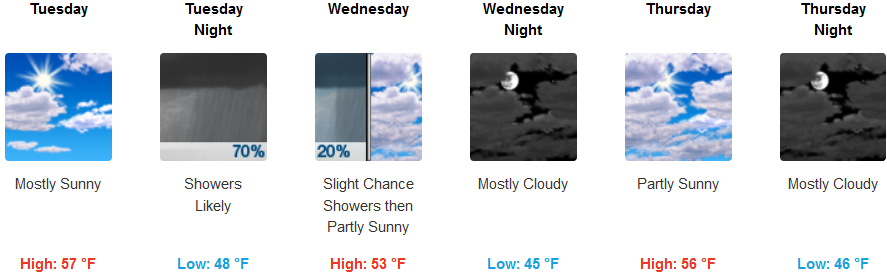
Gold Beach:
Cave Junction:
Grants Pass:
Medford: