


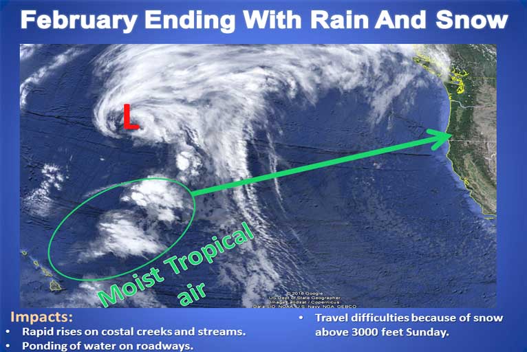
An active weather pattern is expected to start Saturday and lasting through much of next week. Light precipitation is forecast to develop across the North Coast during Saturday. Widespread moderate to heavy rain and gusty south winds will become more probable by Sunday night as a low-pressure system moves onshore across coastal Oregon.
Brookings: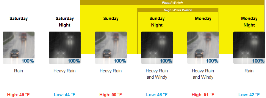
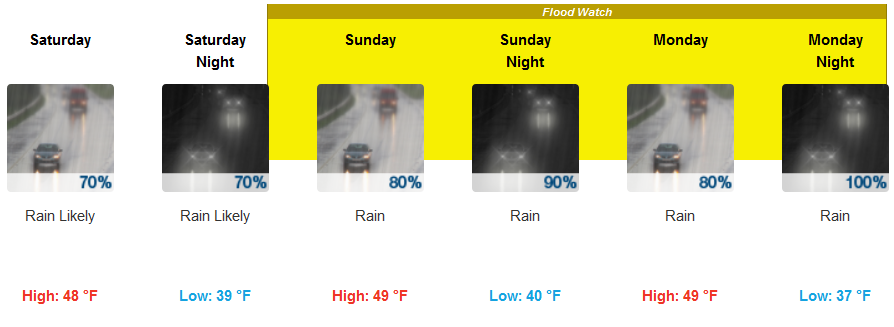
Medford:
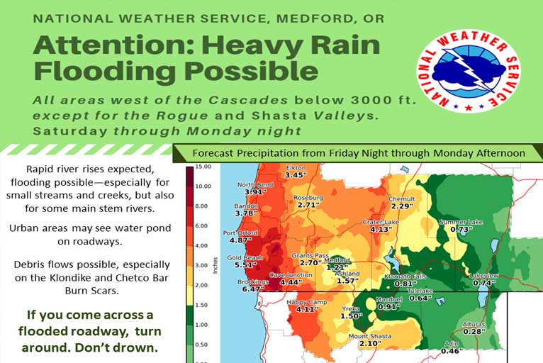
An atmospheric river will focus moisture along a stalled frontal boundary across southern Oregon and northern California. This will generate large amounts of precipitation across the area, which should translate into heavy snowfall for the mountains. Snow levels will be around 4000 to 5000 feet for most of the area, so only the higher terrain is expected to see the extreme snowfall.
Additionally, there will be the possibility for strong winds on Sunday, which over the exposed locations could create near-blizzard conditions. We encourage you to plan on traveling before the winter storm so you don’t have to travel during it. Additional moderate to heavy mountain snowfall will be possible after this system during the week.
The National Weather Service in Medford has issued a High Wind Watch…which is in effect from Sunday evening through Monday afternoon. South winds from 35 to 50 mph with gusts of 70 to 80 mph are possible.
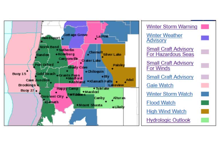
Late Sunday night through Monday morning portions of the southern Oregon coast south of Bandon including Gold Beach, Cape Blanco, Headlands and exposed areas along Highway 101.
Otherwise, in the lower elevations west of the Cascades, Heavy rain is expected this weekend through at least Monday night with moderate rain expected thereafter. The high snow levels could create some rain on snow run-off. This will create rapid rises, especially for small streams and creeks, but some main stem rivers will also see the rapid rises, and could experience some flooding.
Flood Potential Outlook for quick river rises, main stem river flooding, and the potential for snow melt flooding on rivers and streams in the following counties in California, Modoc, Siskiyou, while in Oregon, Coos, Curry, Douglas, Jackson, Josephine, Klamath, and Lake counties will have flooding with potential debris flows in steeper terrain, especially across the recent burn scars such as the Klondike and Chetco Bar burn scars.
Please Like, Share and Follow the …
![]()