

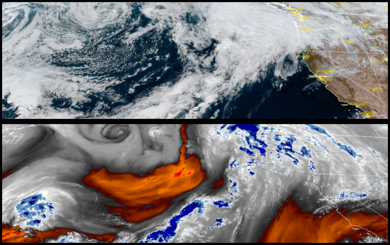
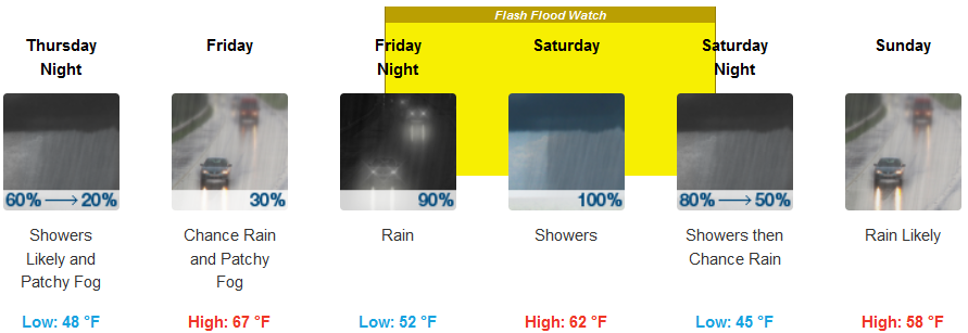
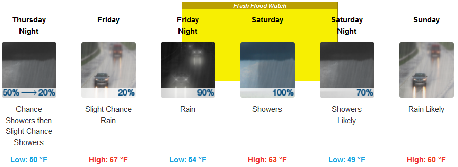
The current weather system moving in to the area has prompted “Flash Flood Warnings” as above average moisture from the first atmospheric river event will bring a heavy precipitation threat into the area which is forecast to usher in additional heavy precipitation late Friday into early Saturday for northern portions of California and southern Oregon.
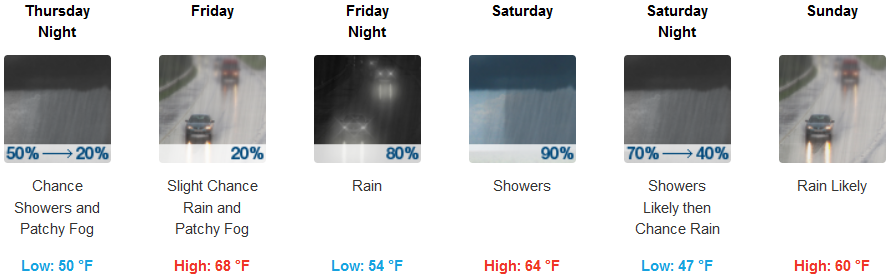
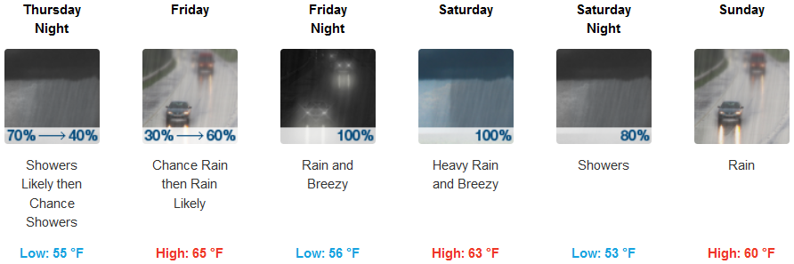
Rain is forecast to start Thursday morning for inland areas, with heavy rain continuing through the weekend with periods of heavy rainfall expected Friday evening through Saturday afternoon across the Smith River Complex burn scar. Temperatures are expected be slightly warmer than earlier in the week with lows in the low 50’s, and afternoon highs in the mid 60’s.
The coast is expected to experience showers and possibly a thunderstorm Thursday, as the first wave of an extended weather system moves onshore, continuing through the weekend with heavy rainfall ranging from 2 to 4 inches over 24 hours across the Smith River Complex burn scar. Coastal areas should expect wind from 7 to 17 mph, with gusts as high as 25 mph with afternoon high temperatures ranging reaching the mid 60’s.
Brookings:
Crescent City:
Gold Beach:
Cave Junction:
Grants Pass:
Medford: