

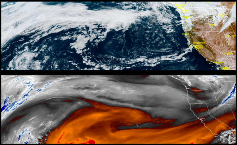
After close to 2 inches of rain since Sunday, a welcomed short break with partly cloudy skies will usher in an upper level trough with more rain and cooler temperatures across the region before moving to the east late in the weekend.
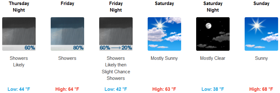
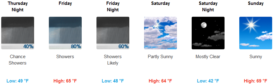
Inland areas are forecast to see increased clouds and chances of precipitation beginning late Thursday and continuing into the weekend before clearing to mostly cloudy skies late in the weekend. Temperatures are expected to be much cooler as the trough moves over the area with highs dropping to low to mid 60’s over the weekend.
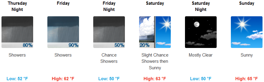
Coastal areas are forecast to see more rain with highest amounts focused at the coast with decreasing values heading inland Thursday night continuing into Friday night before clearing Saturday. High temperatures are expected to stay in the upper 50’s to low 60’s with overnight lows in the low 50’s.
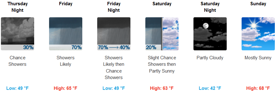
Brookings:
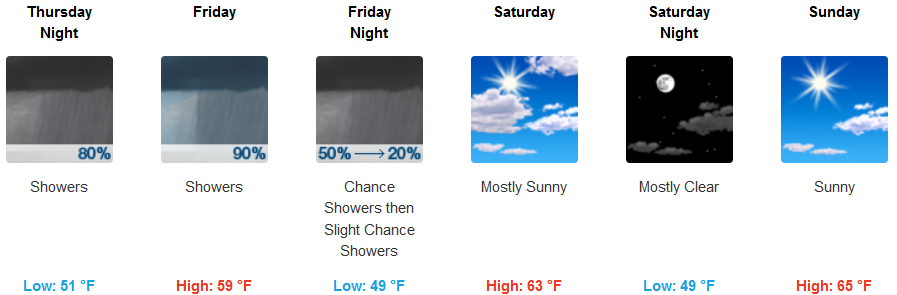
Crescent City:
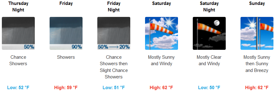
Gold Beach:
Cave Junction:
Grants Pass:
Medford: