

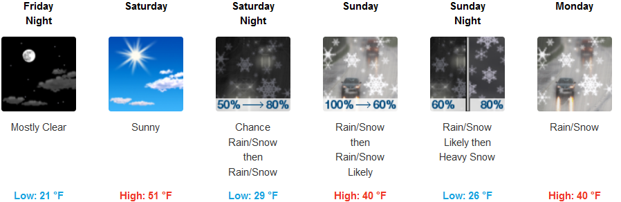
Snow is expected to continue over much of southern Oregon and northern California through Friday morning, growing weaker and more localized as the weather front passes through. As the upper level low spins off the Oregon/Washington coast, it is forecast to push cold unstable air with less moisture into the region. Winter Weather Advisories continue for much of southwestern Oregon and northwestern California with Hard Freeze Warnings continuing along the northern California coastline.
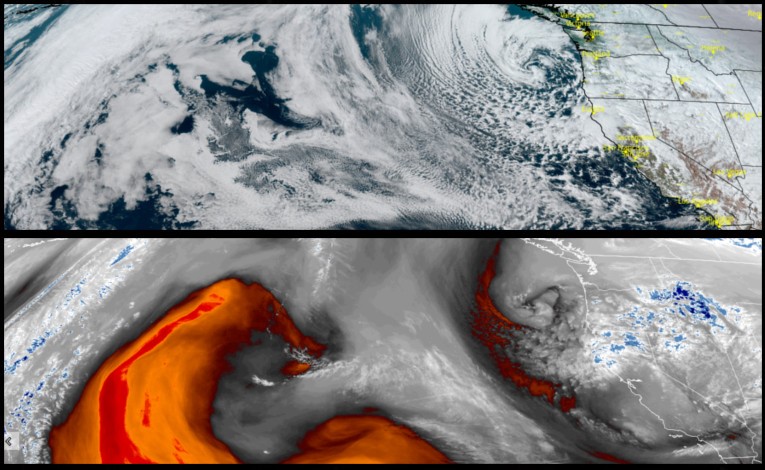
Inland, skies are forecast to begin to clear around noon, continuing through Saturday before another disturbance positions itself to come on shore Sunday. Temperatures are expected to slightly warm Saturday, before dropping from Thursdays low of 31, to the low to mid 20’s for early morning lows Sunday and into Monday with rain and snow beginning early Sunday.
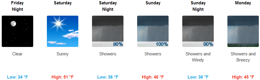
Coastal areas digging out from what will be recorded as record snowfall in some areas, will see the final remnants of the system move on by early Friday morning, with sunshine and mostly clear skies forecast into Saturday before another round of moisture begins to move into the area Saturday evening. Low temperatures along the coast will remain in the low to mid 30’s with afternoon highs reaching the low to mid 50’s.
Brookings:
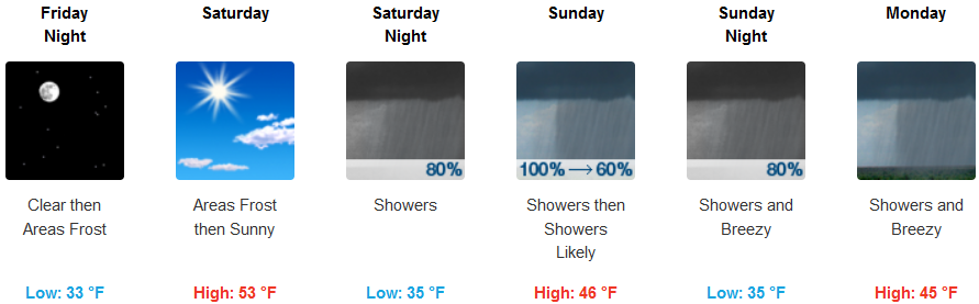
Crescent City:
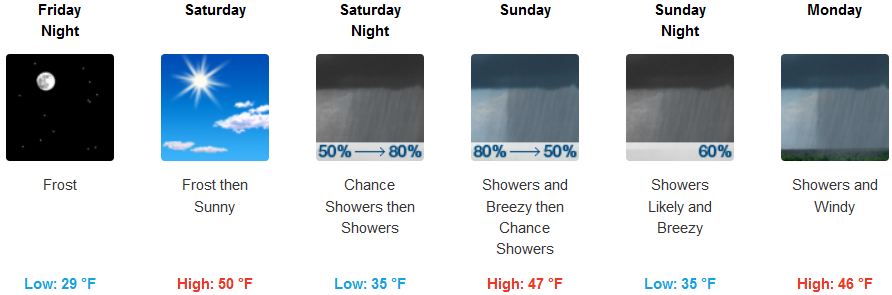
Gold Beach:
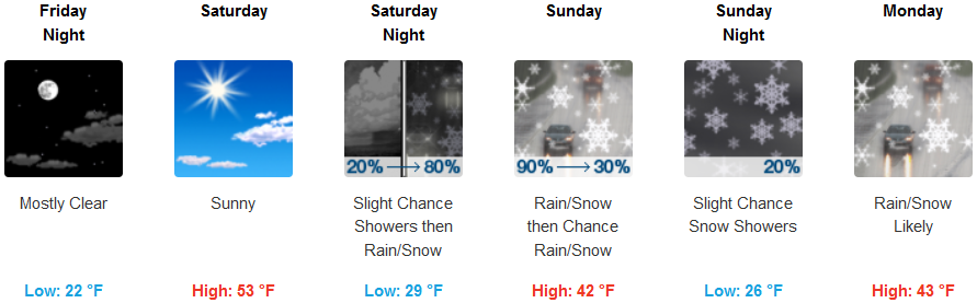
Cave Junction:
Grants Pass:
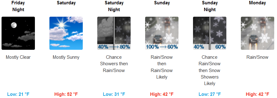
Medford: