


A relatively wet pattern begins for northern California and the Pacific Northwest through the upcoming weekend.
A late-season atmospheric river will take aim at southern Oregon and northern California this weekend. Heaviest rainfall rates are expected Sunday morning through early Monday afternoon, with precipitation totals well above what would typically be seen this time of year. Expect areas of standing water, rapid rises in rivers and streams, and very swift streamflows.
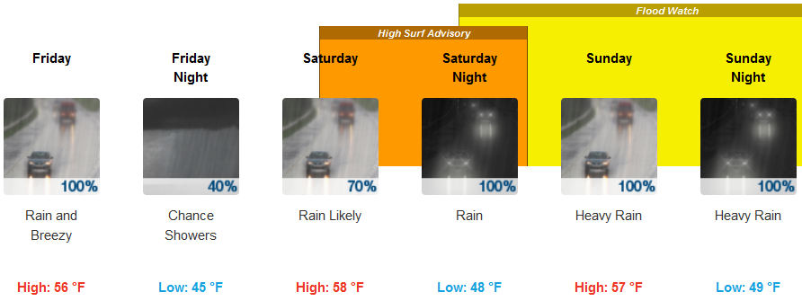
Brookings:
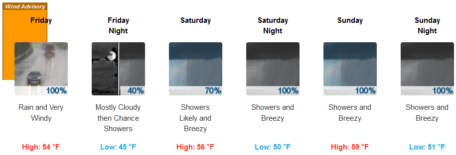
Crescent City:
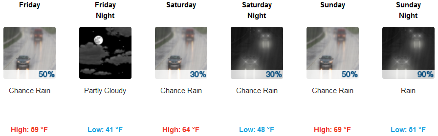
Medford:
Here’s a timeline for tonight through Monday. Areas of light to moderate rain tonight with snow levels lowering to 5500-6500 feet. Friday will see moderate to heavy rain at the coast, Coast Range, and the Cascades.
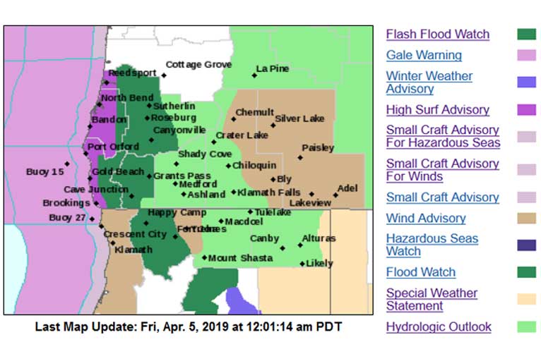
A cold front will quickly move east across northwest California during Friday. Many locations will receive beneficial rainfall totaling near an inch, with west-northwest facing ridges experiencing 1 to 2 inches. After Friday, a stream of moist air is forecast to impact the region Sunday and Monday. This stream of moist air will reside over Del Norte County the longest, resulting in an additional 2 to 4 inches of rain Sunday afternoon and evening. Moderate to heavy rain is then forecast to spread south across Humboldt and Mendocino Counties during Monday.
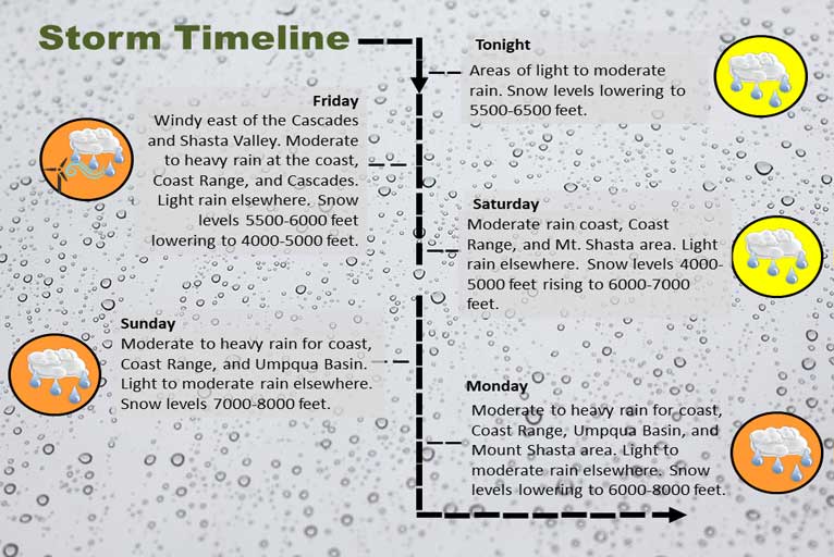
Another round of moderate to heavy rain will develop Sunday along the coast, in the Coast Range, and in the Umpqua Basin with snow levels 7000-8000 feet. The heavier precipitation will continue into Monday and spread to the Mt. Shasta area with snow levels lowering to 6000-8000 feet.
Please Like, Share and Follow the …
![]()