

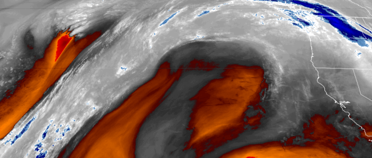
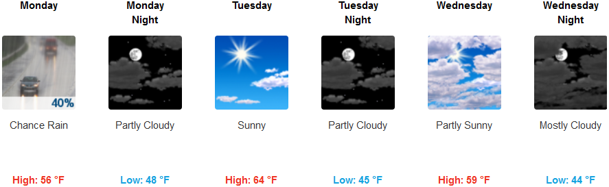
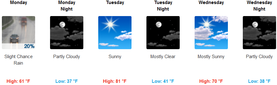
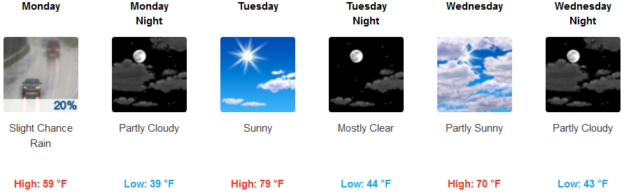
A large dome of high pressure currently circulating off the northern California, southern Oregon coast is directing current approaching weather systems to the north, impacting Washington, while creating a large area of stable air moving onshore.
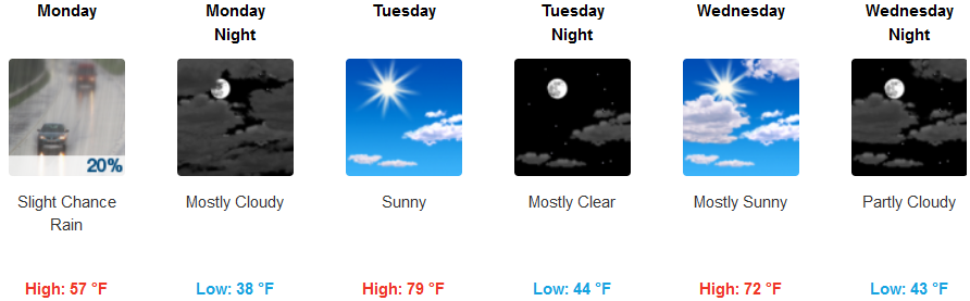
After a slight chance of showers Monday, a spring warm up will start the work week and continue through mid week. Much warmer temperatures and dry conditions are in store for Tuesday and Wednesday with highs in the 70’s and near 80 for valleys with low temperatures in the low 40’s.
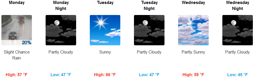
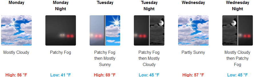
Coastal regions, just as inland areas, could see a very slight chance of showers from the southern edge of a system passing to the north Monday, clearing to partly cloudy skies and warm afternoon temperatures to start the work week. Low temperatures will be in the low to mid 40’s, with clear, sunny afternoon skies and high temperatures in the upper 60’s through mid-week.
Brookings:
Crescent City:
Gold Beach:
Cave Junction:
Grants Pass:
Medford: