

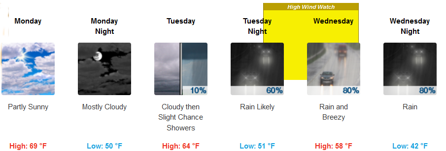
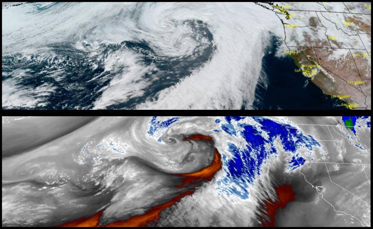
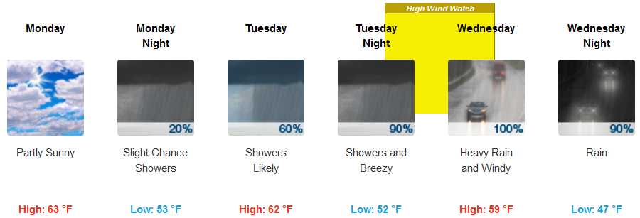
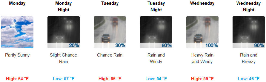
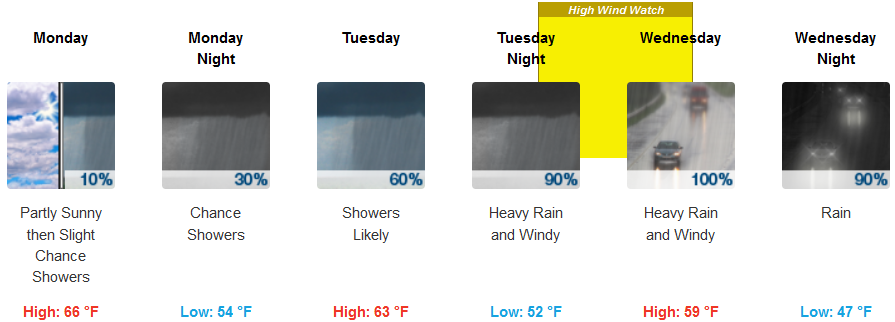
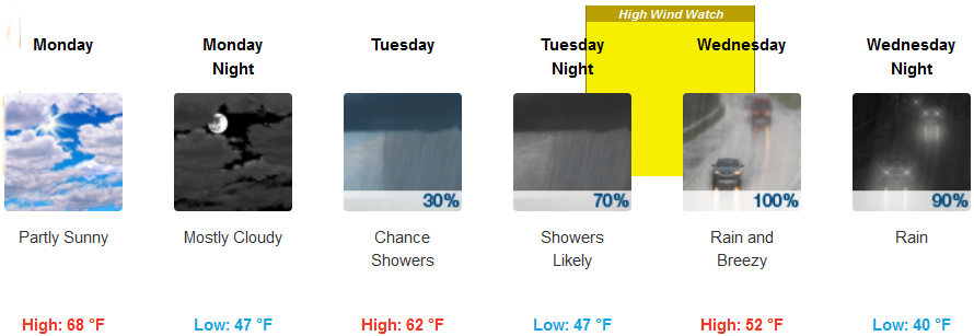
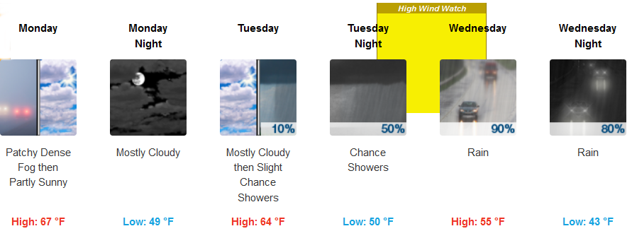
Warmer dryer weather was enjoyed over southern Oregon and northern California Sunday and is forecast to continue through Monday and much of Tuesday to start the work week before another cooler and wet weather system moves into the region by mid-week.
Inland areas are expected to wake up to dense fog in some areas clearing as the day progresses under partly sunny skies. Temperatures are forecast to be relatively warm to start the week, cooling by mid-week as another powerful weather system begins to move into northern California. Lows are expected to be in the upper 40’s to start the week, dropping to low 40’s with highs in the mid to upper 60’s dropping to low 50’s by mid-week.
Along the coast warmer days are forecast to continue with partly sunny skies changing to mostly cloudy skies and a slight chance of rain by late Tuesday. Temperatures will remain relatively warm with highs in the mid 60’s through Tuesday before cooling to the low 50’s by mid-week. Strong winds are expected Tuesday night through Wednesday afternoon with south winds possibly reaching 30-40 mph and low temperatures falling to the low to mid 40’s.
Brookings:
Crescent City:
Gold Beach:
Cave Junction:
Grants Pass:
Medford: